Pointcloud Measuring
On this page
Measuring in the Pointcloud Pane
Use the Pointcloud Pane for taking precise 3D measurements or elevation cross-sections.
Note: If the pane is not open, first click the three pane view button to add the Pointcloud Pane to the screen alongside the map pane and photo pane or the cloud button in the Navigation Bar for a full screen of the Pointcloud Pane
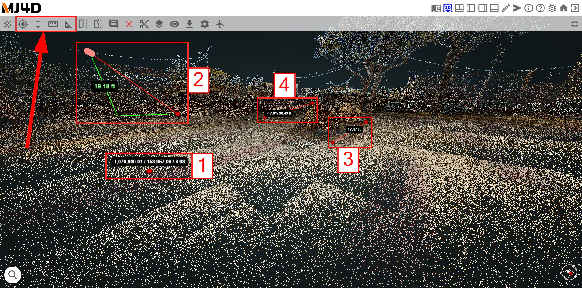
There are four types of measurements available in the Pointcloud Pane:
Measure Point : Measure the X, Y and Z coordinates of a given point in the coordinate system native to the pointcloud by clicking a point.
Measure Height : Measure the difference in height between two points in the pointcloud by clicking the starting point then clicking the end point.
Measure Distance : Measure the distance in feet between two points in the pointcloud by clicking the first point, the second point, then right-clicking.
Measure Slope : Measure both the approximate slope and the distance between two points in the pointcloud by clicking the starting point then clicking the end point.
The finished measurement can be adjusted by dragging the red circles at the endpoints of the measurement to the new desired location.
