Alignments
On this page
To get started with Alignments in the Map Pane, select the Alignments tool in the Map Pane toolbar:
![]()
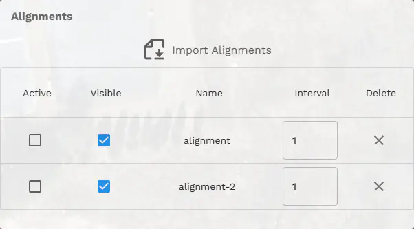
Selecting this icon will show the Alignments dropdown menu:

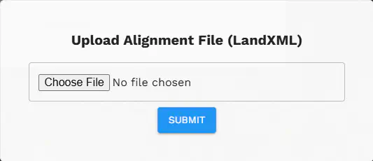
Some MJ4D projects come with pre-loaded alignments, but to add alignments to any project select the “Import Alignments” button. Selecting this will open the LandXML upload form. Alignments you upload yourself are exclusive to your individual browser/session.

The supported filetype for Alignments is LandXML. A single file can have multiple Alignments defined.
Alignments Menu
Once Alignments have been added to the MJ4D project you can start using the Aligments menu.

Active
Selecting an Alignment as active will set it as the default Alignment that can be assigned to a PinPoint item. This will also make all other Alignments on the screen transparent making it easier to identify what Alignment you want to focus on.
Visible
Toggles the visibility on/off for a specific Alignment.
Name
The name of a specific Alignment as defined in the LandXML file, seen in the Alignments Menu
Interval
This is the interval of which each Alignment Station Annotation will show. (e.g. an interval of 3 will show every 3rd station annotation along the alignment).
Delete
Click the “X” marker to delete a specific Alignment.